We spent another night in Kota Kinabalu before continuing our flight back to Kuala Lumpur the next day.
That was the end of our program in Sabah in 2013, a memory that I can't forget because we were in Sabah a week after Hari Raya Aidilfitri... the song of Raya still echoed in Sabah when we ran the health program here.
Kota Marudu is quite a long way if you're in Kota Kinabalu but for us it was worth a visit, a small town but beautiful upcoming tourist destination.
There are many other areas in Sabah that I have visited but not many memorable photos have been saved. Districts such as Sandakan, Keningau, Tawau and so on.
KENINGAU
Keningau is Sabah’s fifth largest town and houses the largest park in Sabah which is the Crocker Range National Park. Visitors who wish to check out the traditional items of Keningau may head to the Keningau Handicraft Centre to know more details about the numerous handicrafts that’s available there.
My colleagues and I involved in the Heart Disease Health program at Sek. Keb. Sook, Keningau, Sabah on April 4, 2015.
BANJARAN CROCKER
Banjaran Crocker or Crocker Range is a mountain range extending from the West Coast until interior divisions of Sabah, that separates the west and east coast of Sabah. It is named after the British Administrator in North Borneo,
William Maunder Crocker.
Inobong Sub-Station is one of the substation around Crocker Ranger Park, which is the largest national park in Sabah with a vast mountain range. There are a few substations around the Crocker Range such as Inobong, Malungung and Buayan.
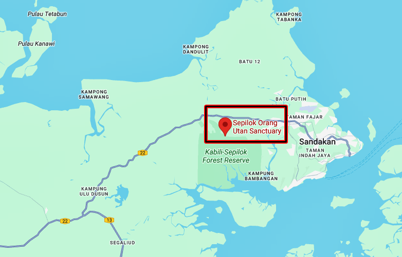
SEPILOK, SANDAKAN
Sepilok is a small town in Sabah, 26 km from Sandakan. It is famous for its Sunbear and Orangutan Rehabilitation Centre.
When I served with RMN ships in the 80s and 90s, our ships often stopped at Sandakan Port to refuel and fulfill other logistical needs.
TAWAU, SABAH
Tawau is another destination that I often visit when serving with Royal Malaysian Navy ships and often stop at the TLDM Jetty at KD Sri Tawau.
Tawau is the third largest city in Sabah, after Kota Kinabalu and Sandakan, located on the Semporna Peninsula, bordered by Sulu Sea to the east, the Celebes Sea in the South at Cowie Bay.
KALABAKAN, TAWAU
The Tragedy of Kalabakan in Tawau on December 29, 1963 is still fresh in the mind of Sabahans. Eight military personal from the 3rd Battalion Royal Malay Regiment were killed in action and 18 injured when the Indonesian Army attacked the Military checkpoint. A memorial was built at the site of the battle to commemorate the soldiers who died in the battle. Kalabakan is located about 55 km west of the town of Tawau.

MALIAU BASIN - SABAH LOST WORLD
A region in Tongod District of Sabah with a total area of 588 sq km, about 40 km north of the Kalimantan Border. It is accessible via the town of Keningau, about four to five hour drives.
It is a remote circular plateau in Borneo that remained largely unknown to the outside world until the late 20th century. Its "mysterious" stem from its unique geology, isolation and local folklore.
It was discovered by the west in 1947 only when a pilot almost crashed into its mist-shrouded cliffs, claiming he had found a place "higher than Kinabalu".
Scientists estimate that over 50% of the basin remains completely unexplored by humans.
For those who trek the basin today, local rangers and Murut guides still observe strict taboos to avoid disturbing the spirits of the forest.
Common "mysteries" reported by visitors include unexplainable sounds, sudden chills, or the feeling of being watched. Taboos include not making fun of wildlife, not being loud, and asking permission before using the "restroom" in the jungle to avoid offending invisible entities.
Refers:
I have very special memory of Sabah, I have many friends from that Land Below the wind, a phrase used by seafarers in the past to described the state that lies below the typhoon belt of East Asia and never battered by any typhoons.
Recommended Reading:
1. Land below the Winds by Agnes Newton Keith


.jpg)


.jpg)
.jpg)

.jpg)

.jpg)
.jpg)
.JPG)
.jpg)
.jpg)

.JPG)
.JPG)
.jpg)
.png)
.jpg)
.jpg)
.JPG)
.png)
.jpg)
.jpg)
.jpg)
.jpg)
.jpg)
.jpg)
.jpg)
.jpg)
.jpg)
.JPG)
.jpg)
.jpg)
.jpg)
.jpg)
.JPG)
.png)
.png)
.jpg)
.png)

.jpg)
.JPG)
.JPG)
.jpg)
.jpg)
.jpg)
.JPG)
.JPG)
.png)
.jpg)
.jpg)
.jpg)
.jpg)
.jpg)
.jpg)
.jpg)

.jpg)
.jpg)
.JPG)
.png)
.JPG)
.png)
.jpg)
.jpg)
.jpg)

.jpg)
.jpg)
.jpg)
.png)
.jpg)
.png)
.png)


.png)


